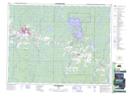
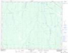
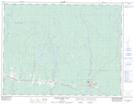
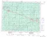
Maps showing Wellington Creek, Cochrane, Ontario
Wellington Creek is a River located in Cochrane, Ontario and has an elevation of 243 meters.
- Latitude: 49° 19' 47'' North (decimal: 49.3297222)
- Longitude: 82° 1' 36'' West (decimal: -82.0266666)
- Topography Feature Category: River
- Geographical Feature: Creek
- Canadian Province/Territory: Ontario
- Elevation: 243 meters
- Location: Cochrane
- Atlas of Canada Locator Map: Wellington Creek
- GPS Coordinate Locator Map: Wellington Creek Lat/Long
Wellington Creek NTS Map Sheets