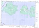
Maps showing Welsh Island, Manitoulin, Ontario
Welsh Island is a Island located in Manitoulin, Ontario and has an elevation of 186 meters.
- Latitude: 45° 54' 58'' North (decimal: 45.9161111)
- Longitude: 83° 5' 24'' West (decimal: -83.0899999)
- Topography Feature Category: Island
- Geographical Feature: Island
- Canadian Province/Territory: Ontario
- Elevation: 186 meters
- Location: Manitoulin
- Atlas of Canada Locator Map: Welsh Island
- GPS Coordinate Locator Map: Welsh Island Lat/Long