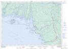
Maps showing Western Channel, Ontario
Western Channel is a Channel located in Ontario and has an elevation of 181 meters.
- Latitude: 45° 57' 56'' North (decimal: 45.9655999)
- Longitude: 80° 58' 13'' West (decimal: -80.9702999)
- Topography Feature Category: Channel
- Geographical Feature: Channel
- Canadian Province/Territory: Ontario
- Elevation: 181 meters
- GPS Coordinate Locator Map: Western Channel Lat/Long
Western Channel NTS Map Sheets