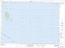
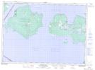
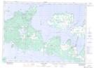
Maps showing Western Duck Island, Manitoulin, Ontario
Western Duck Island is a Island located in Manitoulin, Ontario and has an elevation of 182 meters.
- Latitude: 45° 45' 16'' North (decimal: 45.7544444)
- Longitude: 82° 59' 38'' West (decimal: -82.9938888)
- Topography Feature Category: Island
- Geographical Feature: Island
- Canadian Province/Territory: Ontario
- Elevation: 182 meters
- Location: Manitoulin
- Atlas of Canada Locator Map: Western Duck Island
- GPS Coordinate Locator Map: Western Duck Island Lat/Long
Western Duck Island NTS Map Sheets