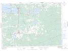
Maps showing West Ferris, Ontario
West Ferris is a Geographical area located in Ontario.
- Latitude: 46° 15' North (decimal: 46.2500000)
- Longitude: 79° 20' West (decimal: -79.3333000)
- Topography Feature Category: Geographical area
- Geographical Feature: Geographic Township
- Canadian Province/Territory: Ontario
- GPS Coordinate Locator Map: West Ferris Lat/Long
West Ferris NTS Map Sheets