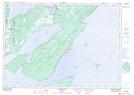
Maps showing West Flat, Manitoulin, Ontario
West Flat is a Shoal located in Manitoulin, Ontario and has an elevation of 177 meters.
- Latitude: 45° 33' 36'' North (decimal: 45.5599999)
- Longitude: 81° 41' 50'' West (decimal: -81.6972222)
- Topography Feature Category: Shoal
- Geographical Feature: Bank
- Canadian Province/Territory: Ontario
- Elevation: 177 meters
- Location: Manitoulin
- Atlas of Canada Locator Map: West Flat
- GPS Coordinate Locator Map: West Flat Lat/Long
West Flat NTS Map Sheets