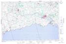
Maps showing West Kelly Drain, Haldimand, Ontario
West Kelly Drain is a Hydraulic construction located in Haldimand, Ontario and has an elevation of 178 meters.
- Latitude: 42° 53' 00'' North (decimal: 42.8833333)
- Longitude: 79° 32' 27'' West (decimal: -79.5408333)
- Topography Feature Category: Hydraulic construction
- Geographical Feature: Drain
- Canadian Province/Territory: Ontario
- Elevation: 178 meters
- Location: Haldimand
- Atlas of Canada Locator Map: West Kelly Drain
- GPS Coordinate Locator Map: West Kelly Drain Lat/Long
West Kelly Drain NTS Map Sheets