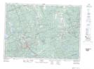
Maps showing West Mullet Lake, Hastings, Ontario
West Mullet Lake is a Lake located in Hastings, Ontario and has an elevation of 363 meters.
- Latitude: 45° 0' 51'' North (decimal: 45.0141666)
- Longitude: 77° 50' 32'' West (decimal: -77.8422222)
- Topography Feature Category: Lake
- Geographical Feature: Lake
- Canadian Province/Territory: Ontario
- Elevation: 363 meters
- Location: Hastings
- Atlas of Canada Locator Map: West Mullet Lake
- GPS Coordinate Locator Map: West Mullet Lake Lat/Long