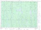
Maps showing Westree, Sudbury, Ontario
Westree is a Unincorporated area located in Sudbury, Ontario and has an elevation of 412 meters.
- Latitude: 47° 25' 8'' North (decimal: 47.4188888)
- Longitude: 81° 32' 43'' West (decimal: -81.5452777)
- Topography Feature Category: Unincorporated area
- Geographical Feature: Dispersed Rural Community
- Canadian Province/Territory: Ontario
- Elevation: 412 meters
- Location: Sudbury
- Atlas of Canada Locator Map: Westree
- GPS Coordinate Locator Map: Westree Lat/Long