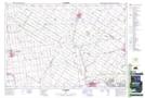
Maps showing Whalen Corners, Middlesex; Perth; Huron, Ontario
Whalen Corners is a Unincorporated area located in Middlesex; Perth; Huron, Ontario and has an elevation of 298 meters.
- Latitude: 43° 15' 45'' North (decimal: 43.2625000)
- Longitude: 81° 21' 41'' West (decimal: -81.3613888)
- Topography Feature Category: Unincorporated area
- Geographical Feature: Dispersed Rural Community
- Canadian Province/Territory: Ontario
- Elevation: 298 meters
- Location: Middlesex; Perth; Huron
- Atlas of Canada Locator Map: Whalen Corners
- GPS Coordinate Locator Map: Whalen Corners Lat/Long