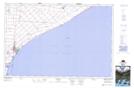
Maps showing Wheatley, Essex; Kent, Ontario
Wheatley is a Unincorporated area located in Essex; Kent, Ontario and has an elevation of 180 meters.
- Latitude: 42° 5' 38'' North (decimal: 42.0938888)
- Longitude: 82° 27' 43'' West (decimal: -82.4619444)
- Topography Feature Category: Unincorporated area
- Geographical Feature: Community
- Canadian Province/Territory: Ontario
- Elevation: 180 meters
- Location: Essex; Kent
- Atlas of Canada Locator Map: Wheatley
- GPS Coordinate Locator Map: Wheatley Lat/Long