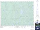
Maps showing Whitemud Lake, Timiskaming, Ontario
Whitemud Lake is a Lake located in Timiskaming, Ontario and has an elevation of 404 meters.
- Latitude: 47° 20' 52'' North (decimal: 47.3477777)
- Longitude: 80° 40' 59'' West (decimal: -80.6830555)
- Topography Feature Category: Lake
- Geographical Feature: Lake
- Canadian Province/Territory: Ontario
- Elevation: 404 meters
- Location: Timiskaming
- Atlas of Canada Locator Map: Whitemud Lake
- GPS Coordinate Locator Map: Whitemud Lake Lat/Long
Whitemud Lake NTS Map Sheets