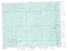
Maps showing White Water Lily Lake, Algoma, Ontario
White Water Lily Lake is a Lake located in Algoma, Ontario and has an elevation of 426 meters.
- Latitude: 48° 15' 46'' North (decimal: 48.2627777)
- Longitude: 84° 59' 9'' West (decimal: -84.9858333)
- Topography Feature Category: Lake
- Geographical Feature: Lake
- Canadian Province/Territory: Ontario
- Elevation: 426 meters
- Location: Algoma
- Atlas of Canada Locator Map: White Water Lily Lake
- GPS Coordinate Locator Map: White Water Lily Lake Lat/Long
White Water Lily Lake NTS Map Sheets