Canada Topographic Maps

Wicksteed Harbour Topo Maps

Topography maps and Latitude/Longitude Location

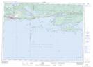
Maps showing Wicksteed Harbour, Ontario

Wicksteed Harbour is a Bay located in Ontario.

  • Latitude: 46° 10' North   (decimal: 46.1666999)
  • Longitude: 82° 38' West   (decimal: -82.6332999)
  • Topography Feature Category: Bay
  • Geographical Feature: Harbour
  • Canadian Province/Territory: Ontario
  • GPS Coordinate Locator Map: Wicksteed Harbour Lat/Long

Wicksteed Harbour NTS Map Sheets

041J02 Algoma Topographic Map at 1:50,000 scale

041J Blind River Topographic Map at 1:250,000 scale

 
Buy Topographic Maps DVD
Newsletter Sign-up

Yes, I want to receive map store discounts.


Bookmark and Share