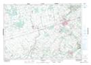
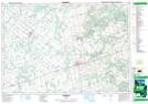
Maps showing Willow Brook, Dufferin, Ontario
Willow Brook is a River located in Dufferin, Ontario and has an elevation of 484 meters.
- Latitude: 43° 53' 32'' North (decimal: 43.8922222)
- Longitude: 80° 17' 1'' West (decimal: -80.2836111)
- Topography Feature Category: River
- Geographical Feature: Brook
- Canadian Province/Territory: Ontario
- Elevation: 484 meters
- Location: Dufferin
- Atlas of Canada Locator Map: Willow Brook
- GPS Coordinate Locator Map: Willow Brook Lat/Long
Willow Brook NTS Map Sheets