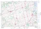
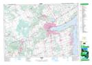
Maps showing Wilson Creek, Simcoe, Ontario
Wilson Creek is a River located in Simcoe, Ontario and has an elevation of 242 meters.
- Latitude: 44° 15' 26'' North (decimal: 44.2572222)
- Longitude: 79° 32' 30'' West (decimal: -79.5416666)
- Topography Feature Category: River
- Geographical Feature: Creek
- Canadian Province/Territory: Ontario
- Elevation: 242 meters
- Location: Simcoe
- Atlas of Canada Locator Map: Wilson Creek
- GPS Coordinate Locator Map: Wilson Creek Lat/Long
Wilson Creek NTS Map Sheets