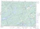
Maps showing Wilson Hill, Lanark, Ontario
Wilson Hill is a Mountain located in Lanark, Ontario and has an elevation of 239 meters.
- Latitude: 44° 55' 30'' North (decimal: 44.9250000)
- Longitude: 76° 37' 26'' West (decimal: -76.6238888)
- Topography Feature Category: Mountain
- Geographical Feature: Hill
- Canadian Province/Territory: Ontario
- Elevation: 239 meters
- Location: Lanark
- Atlas of Canada Locator Map: Wilson Hill
- GPS Coordinate Locator Map: Wilson Hill Lat/Long
Wilson Hill NTS Map Sheets