Maps showing Windermere Basin, Wentworth, Ontario
Windermere Basin is a Bay located in Wentworth, Ontario and has an elevation of 75 meters.
- Latitude: 43° 15' 56'' North (decimal: 43.2655555)
- Longitude: 79° 46' 46'' West (decimal: -79.7794444)
- Topography Feature Category: Bay
- Geographical Feature: Basin
- Canadian Province/Territory: Ontario
- Elevation: 75 meters
- Location: Wentworth
- Atlas of Canada Locator Map: Windermere Basin
- GPS Coordinate Locator Map: Windermere Basin Lat/Long
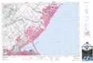
Windermere Basin NTS Map Sheets