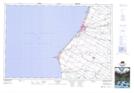
Maps showing Wyley's Hill, Huron, Ontario
Wyley's Hill is a Mountain located in Huron, Ontario and has an elevation of 186 meters.
- Latitude: 44° 1' 8'' North (decimal: 44.0188888)
- Longitude: 81° 42' 38'' West (decimal: -81.7105555)
- Topography Feature Category: Mountain
- Geographical Feature: Hill
- Canadian Province/Territory: Ontario
- Elevation: 186 meters
- Location: Huron
- Atlas of Canada Locator Map: Wyley's Hill
- GPS Coordinate Locator Map: Wyley's Hill Lat/Long
Wyley's Hill NTS Map Sheets