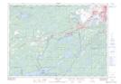
Maps showing Yankee Island, Ontario
Yankee Island is a Island located in Ontario.
- Latitude: 46° 15' 34'' North (decimal: 46.2594000)
- Longitude: 81° 21' 23'' West (decimal: -81.3563999)
- Topography Feature Category: Island
- Geographical Feature: Island
- Canadian Province/Territory: Ontario
- GPS Coordinate Locator Map: Yankee Island Lat/Long
Yankee Island NTS Map Sheets