Canada Topographic Maps

Bracebridge Topo Maps

Topography maps and Latitude/Longitude Location

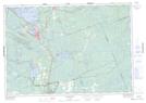
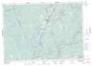
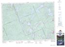
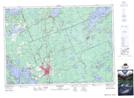
Maps showing Bracebridge, Muskoka, Ontario

Bracebridge is a Town located in Muskoka, Ontario and has an elevation of 247 meters.

  • Latitude: 45° 1' 35'' North   (decimal: 45.0263888)
  • Longitude: 79° 11' 24'' West   (decimal: -79.1899999)
  • Topography Feature Category: Town
  • Geographical Feature: Town
  • Canadian Province/Territory: Ontario
  • Elevation: 247 meters
  • Location: Muskoka
  • Atlas of Canada Locator Map: Bracebridge
  • GPS Coordinate Locator Map: Bracebridge Lat/Long

Bracebridge NTS Map Sheets

031D14 Gravenhurst Topographic Map at 1:50,000 scale

031D15 Minden Topographic Map at 1:50,000 scale

031E02 Haliburton Topographic Map at 1:50,000 scale

031E03 Bracebridge Topographic Map at 1:50,000 scale

031D Lake Simcoe Topographic Map at 1:250,000 scale

031E Huntsville Topographic Map at 1:250,000 scale

 
Buy Topographic Maps DVD
Newsletter Sign-up

Yes, I want to receive map store discounts.


Bookmark and Share