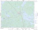
Maps showing Steamboat Narrows, Kenora, Ontario
Steamboat Narrows is a Channel located in Kenora, Ontario and has an elevation of 378 meters.
- Latitude: 50° 33' 28'' North (decimal: 50.5577777)
- Longitude: 93° 3' 26'' West (decimal: -93.0572222)
- Topography Feature Category: Channel
- Geographical Feature: Narrows
- Canadian Province/Territory: Ontario
- Elevation: 378 meters
- Location: Kenora
- Atlas of Canada Locator Map: Steamboat Narrows
- GPS Coordinate Locator Map: Steamboat Narrows Lat/Long