Canada Topographic Maps

Straw Creek Topo Maps

Topography maps and Latitude/Longitude Location

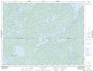
Maps showing Straw Creek, Ontario

Straw Creek is a River located in Ontario.

  • Latitude: 49° 7' 44'' North   (decimal: 49.1288999)
  • Longitude: 93° 26' 10'' West   (decimal: -93.4360999)
  • Topography Feature Category: River
  • Geographical Feature: Creek
  • Canadian Province/Territory: Ontario
  • GPS Coordinate Locator Map: Straw Creek Lat/Long

Straw Creek NTS Map Sheets

052F03 Harris Lake Topographic Map at 1:50,000 scale

052F Dryden Topographic Map at 1:250,000 scale

 
Buy Topographic Maps DVD
Newsletter Sign-up

Yes, I want to receive map store discounts.


Bookmark and Share