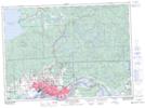
Maps showing Clay Hill, Algoma, Ontario
Clay Hill is a Mountain located in Algoma, Ontario and has an elevation of 210 meters.
- Latitude: 46° 33' 28'' North (decimal: 46.5577777)
- Longitude: 84° 8' 27'' West (decimal: -84.1408333)
- Topography Feature Category: Mountain
- Geographical Feature: Hill
- Canadian Province/Territory: Ontario
- Elevation: 210 meters
- Location: Algoma
- Atlas of Canada Locator Map: Clay Hill
- GPS Coordinate Locator Map: Clay Hill Lat/Long
Clay Hill NTS Map Sheets