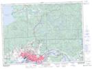
Maps showing Echo River, Algoma, Ontario
Echo River is a Unincorporated area located in Algoma, Ontario and has an elevation of 185 meters.
- Latitude: 46° 30' 35'' North (decimal: 46.5097222)
- Longitude: 84° 2' 15'' West (decimal: -84.0374999)
- Topography Feature Category: Unincorporated area
- Geographical Feature: Dispersed Rural Community
- Canadian Province/Territory: Ontario
- Elevation: 185 meters
- Location: Algoma
- Atlas of Canada Locator Map: Echo River
- GPS Coordinate Locator Map: Echo River Lat/Long
Echo River NTS Map Sheets