Maps showing Florin Creek, Kenora, Ontario
Florin Creek is a River located in Kenora, Ontario.
- Latitude: 51° 1' 15'' North (decimal: 51.0208333)
- Longitude: 93° 48' 50'' West (decimal: -93.8138888)
- Topography Feature Category: River
- Geographical Feature: Creek
- Canadian Province/Territory: Ontario
- Location: Kenora
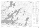
- Atlas of Canada Locator Map: Florin Creek
- GPS Coordinate Locator Map: Florin Creek Lat/Long
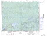
Florin Creek NTS Map Sheets