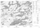
Maps showing Dinner Place Point, Kenora, Ontario
Dinner Place Point is a Cape located in Kenora, Ontario.
- Latitude: 50° 2' 56'' North (decimal: 50.0488888)
- Longitude: 92° 10' 51'' West (decimal: -92.1808333)
- Topography Feature Category: Cape
- Geographical Feature: Point
- Canadian Province/Territory: Ontario
- Location: Kenora
- Atlas of Canada Locator Map: Dinner Place Point
- GPS Coordinate Locator Map: Dinner Place Point Lat/Long