Canada Topographic Maps

Lower Manitou Falls Topo Maps

Topography maps and Latitude/Longitude Location

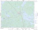
Maps showing Lower Manitou Falls, Ontario

Lower Manitou Falls is a Falls located in Ontario.

  • Latitude: 50° 35' 00'' North   (decimal: 50.5832999)
  • Longitude: 93° 27' 10'' West   (decimal: -93.4527999)
  • Topography Feature Category: Falls
  • Geographical Feature: Falls
  • Canadian Province/Territory: Ontario
  • GPS Coordinate Locator Map: Lower Manitou Falls Lat/Long

Lower Manitou Falls NTS Map Sheets

052K11 Ear Falls Topographic Map at 1:50,000 scale

052K Lac Seul Topographic Map at 1:250,000 scale

 
Buy Topographic Maps DVD
Newsletter Sign-up

Yes, I want to receive map store discounts.


Bookmark and Share