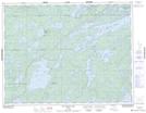
Maps showing Big Vermilion Lake, Kenora, Ontario
Big Vermilion Lake is a Lake located in Kenora, Ontario and has an elevation of 388 meters.
- Latitude: 50° 2' 12'' North (decimal: 50.0366666)
- Longitude: 92° 13' 24'' West (decimal: -92.2233333)
- Topography Feature Category: Lake
- Geographical Feature: Lake
- Canadian Province/Territory: Ontario
- Elevation: 388 meters
- Location: Kenora
- Atlas of Canada Locator Map: Big Vermilion Lake
- GPS Coordinate Locator Map: Big Vermilion Lake Lat/Long
Big Vermilion Lake NTS Map Sheets