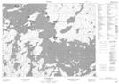
Maps showing Foxon's Light, Kenora, Ontario
Foxon's Light is a Island located in Kenora, Ontario.
- Latitude: 50° 21' 20'' North (decimal: 50.3555555)
- Longitude: 92° 42' 11'' West (decimal: -92.7030555)
- Topography Feature Category: Island
- Geographical Feature: Island
- Canadian Province/Territory: Ontario
- Location: Kenora
- Atlas of Canada Locator Map: Foxon's Light
- GPS Coordinate Locator Map: Foxon's Light Lat/Long
Foxon's Light NTS Map Sheets