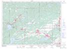
Maps showing Gorham's Landing, Sudbury, Ontario
Gorham's Landing is a Marine navigation feature located in Sudbury, Ontario and has an elevation of 347 meters.
- Latitude: 46° 35' 53'' North (decimal: 46.5980555)
- Longitude: 81° 24' 32'' West (decimal: -81.4088888)
- Topography Feature Category: Marine navigation feature
- Geographical Feature: Landing
- Canadian Province/Territory: Ontario
- Elevation: 347 meters
- Location: Sudbury
- Atlas of Canada Locator Map: Gorham's Landing
- GPS Coordinate Locator Map: Gorham's Landing Lat/Long