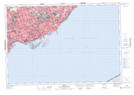
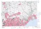
Maps showing Guildwood Village, York, Ontario
Guildwood Village is a Unincorporated area located in York, Ontario and has an elevation of 113 meters.
- Latitude: 43° 44' 14'' North (decimal: 43.7372222)
- Longitude: 79° 11' 32'' West (decimal: -79.1922222)
- Topography Feature Category: Unincorporated area
- Geographical Feature: Urban Community
- Canadian Province/Territory: Ontario
- Elevation: 113 meters
- Location: York
- Atlas of Canada Locator Map: Guildwood Village
- GPS Coordinate Locator Map: Guildwood Village Lat/Long
Guildwood Village NTS Map Sheets