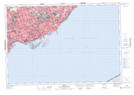
Maps showing Hanlan's Point, York, Ontario
Hanlan's Point is a Cape located in York, Ontario and has an elevation of 74 meters.
- Latitude: 43° 37' 28'' North (decimal: 43.6244444)
- Longitude: 79° 23' 12'' West (decimal: -79.3866666)
- Topography Feature Category: Cape
- Geographical Feature: Point
- Canadian Province/Territory: Ontario
- Elevation: 74 meters
- Location: York
- Atlas of Canada Locator Map: Hanlan's Point
- GPS Coordinate Locator Map: Hanlan's Point Lat/Long