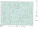
Maps showing Togo Rapids, Sudbury, Ontario
Togo Rapids is a Rapids located in Sudbury, Ontario and has an elevation of 344 meters.
- Latitude: 47° 44' 10'' North (decimal: 47.7361111)
- Longitude: 81° 34' 29'' West (decimal: -81.5747222)
- Topography Feature Category: Rapids
- Geographical Feature: Rapids
- Canadian Province/Territory: Ontario
- Elevation: 344 meters
- Location: Sudbury
- Atlas of Canada Locator Map: Togo Rapids
- GPS Coordinate Locator Map: Togo Rapids Lat/Long