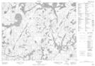
Maps showing Twenty Mile Creek, Kenora, Ontario
Twenty Mile Creek is a River located in Kenora, Ontario.
- Latitude: 50° 0' 12'' North (decimal: 50.0033333)
- Longitude: 92° 54' 35'' West (decimal: -92.9097222)
- Topography Feature Category: River
- Geographical Feature: Creek
- Canadian Province/Territory: Ontario
- Location: Kenora
- Atlas of Canada Locator Map: Twenty Mile Creek
- GPS Coordinate Locator Map: Twenty Mile Creek Lat/Long
Twenty Mile Creek NTS Map Sheets