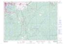
Maps showing White Pine Chutes, Sudbury, Ontario
White Pine Chutes is a Falls located in Sudbury, Ontario and has an elevation of 231 meters.
- Latitude: 46° 22' 11'' North (decimal: 46.3697222)
- Longitude: 80° 49' 31'' West (decimal: -80.8252777)
- Topography Feature Category: Falls
- Geographical Feature: Falls
- Canadian Province/Territory: Ontario
- Elevation: 231 meters
- Location: Sudbury
- Atlas of Canada Locator Map: White Pine Chutes
- GPS Coordinate Locator Map: White Pine Chutes Lat/Long