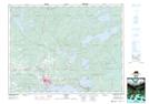
Maps showing McKay's Point, Kenora, Ontario
McKay's Point is a Cape located in Kenora, Ontario and has an elevation of 390 meters.
- Latitude: 49° 47' 10'' North (decimal: 49.7861111)
- Longitude: 92° 38' 51'' West (decimal: -92.6475000)
- Topography Feature Category: Cape
- Geographical Feature: Point
- Canadian Province/Territory: Ontario
- Elevation: 390 meters
- Location: Kenora
- Atlas of Canada Locator Map: McKay's Point
- GPS Coordinate Locator Map: McKay's Point Lat/Long