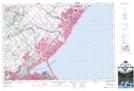
Maps showing Nassagaweya Canyon, Halton, Ontario
Nassagaweya Canyon is a Valley located in Halton, Ontario and has an elevation of 277 meters.
- Latitude: 43° 28' 36'' North (decimal: 43.4766666)
- Longitude: 79° 56' 25'' West (decimal: -79.9402777)
- Topography Feature Category: Valley
- Geographical Feature: Canyon
- Canadian Province/Territory: Ontario
- Elevation: 277 meters
- Location: Halton
- Atlas of Canada Locator Map: Nassagaweya Canyon
- GPS Coordinate Locator Map: Nassagaweya Canyon Lat/Long
Nassagaweya Canyon NTS Map Sheets