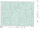
Maps showing Lawson's Creek, Sudbury, Ontario
Lawson's Creek is a River located in Sudbury, Ontario and has an elevation of 372 meters.
- Latitude: 47° 41' 40'' North (decimal: 47.6944444)
- Longitude: 81° 40' 59'' West (decimal: -81.6830555)
- Topography Feature Category: River
- Geographical Feature: Creek
- Canadian Province/Territory: Ontario
- Elevation: 372 meters
- Location: Sudbury
- Atlas of Canada Locator Map: Lawson's Creek
- GPS Coordinate Locator Map: Lawson's Creek Lat/Long