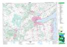
Maps showing Lisle Creek, Simcoe, Ontario
Lisle Creek is a River located in Simcoe, Ontario and has an elevation of 246 meters.
- Latitude: 44° 16' 15'' North (decimal: 44.2708333)
- Longitude: 79° 56' 31'' West (decimal: -79.9419444)
- Topography Feature Category: River
- Geographical Feature: Creek
- Canadian Province/Territory: Ontario
- Elevation: 246 meters
- Location: Simcoe
- Atlas of Canada Locator Map: Lisle Creek
- GPS Coordinate Locator Map: Lisle Creek Lat/Long
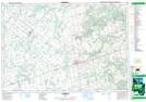
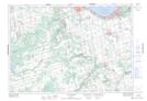
Lisle Creek NTS Map Sheets