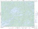
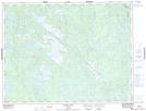
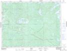
Maps showing Long Lake River, Kenora, Ontario
Long Lake River is a River located in Kenora, Ontario and has an elevation of 437 meters.
- Latitude: 49° 34' 4'' North (decimal: 49.5677777)
- Longitude: 92° 26' 30'' West (decimal: -92.4416666)
- Topography Feature Category: River
- Geographical Feature: River
- Canadian Province/Territory: Ontario
- Elevation: 437 meters
- Location: Kenora
- Atlas of Canada Locator Map: Long Lake River
- GPS Coordinate Locator Map: Long Lake River Lat/Long
Long Lake River NTS Map Sheets