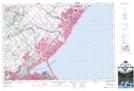
Maps showing Hidden Valley, Wentworth, Ontario
Hidden Valley is a Valley located in Wentworth, Ontario and has an elevation of 118 meters.
- Latitude: 43° 18' 33'' North (decimal: 43.3091666)
- Longitude: 79° 52' 21'' West (decimal: -79.8725000)
- Topography Feature Category: Valley
- Geographical Feature: Valley
- Canadian Province/Territory: Ontario
- Elevation: 118 meters
- Location: Wentworth
- Atlas of Canada Locator Map: Hidden Valley
- GPS Coordinate Locator Map: Hidden Valley Lat/Long
Hidden Valley NTS Map Sheets