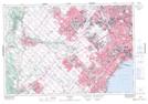
Maps showing Mill Pond, Halton, Ontario
Mill Pond is a Lake located in Halton, Ontario and has an elevation of 199 meters.
- Latitude: 43° 30' 56'' North (decimal: 43.5155555)
- Longitude: 79° 53' 11'' West (decimal: -79.8863888)
- Topography Feature Category: Lake
- Geographical Feature: Pond
- Canadian Province/Territory: Ontario
- Elevation: 199 meters
- Location: Halton
- Atlas of Canada Locator Map: Mill Pond
- GPS Coordinate Locator Map: Mill Pond Lat/Long