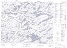
Maps showing Mulcahy, Kenora, Ontario
Mulcahy is a Geographical area located in Kenora, Ontario.
- Latitude: 50° 58' 27'' North (decimal: 50.9741666)
- Longitude: 94° 14' 44'' West (decimal: -94.2455555)
- Topography Feature Category: Geographical area
- Geographical Feature: Geographic Township
- Canadian Province/Territory: Ontario
- Location: Kenora
- Atlas of Canada Locator Map: Mulcahy
- GPS Coordinate Locator Map: Mulcahy Lat/Long
Mulcahy NTS Map Sheets