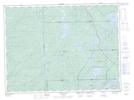
Maps showing Parkinson's Pothole, Algoma, Ontario
Parkinson's Pothole is a Lake located in Algoma, Ontario.
- Latitude: 48° 21' 4'' North (decimal: 48.3511111)
- Longitude: 85° 3' 27'' West (decimal: -85.0574999)
- Topography Feature Category: Lake
- Geographical Feature: Pothole
- Canadian Province/Territory: Ontario
- Location: Algoma
- Atlas of Canada Locator Map: Parkinson's Pothole
- GPS Coordinate Locator Map: Parkinson's Pothole Lat/Long
Parkinson's Pothole NTS Map Sheets