Canada Topographic Maps

Percy Topo Maps

Topography maps and Latitude/Longitude Location

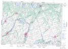
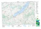
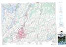
Maps showing Percy, Northumberland, Ontario

Percy is a Geographical area located in Northumberland, Ontario.

  • Latitude: 44° 15' 7'' North   (decimal: 44.2519444)
  • Longitude: 77° 55' 59'' West   (decimal: -77.9330555)
  • Topography Feature Category: Geographical area
  • Geographical Feature: Geographic Township
  • Canadian Province/Territory: Ontario
  • Location: Northumberland
  • Atlas of Canada Locator Map: Percy
  • GPS Coordinate Locator Map: Percy Lat/Long

Percy NTS Map Sheets

031C04 Trenton Topographic Map at 1:50,000 scale

031C05 Campbellford Topographic Map at 1:50,000 scale

031D01 Rice Lake Topographic Map at 1:50,000 scale

031D08 Peterborough Topographic Map at 1:50,000 scale

031C Kingston Topographic Map at 1:250,000 scale

031D Lake Simcoe Topographic Map at 1:250,000 scale

 
Buy Topographic Maps DVD
Newsletter Sign-up

Yes, I want to receive map store discounts.


Bookmark and Share