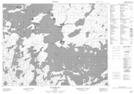
Maps showing Rocky Point, Kenora, Ontario
Rocky Point is a Cape located in Kenora, Ontario.
- Latitude: 50° 21' 32'' North (decimal: 50.3588888)
- Longitude: 92° 38' 53'' West (decimal: -92.6480555)
- Topography Feature Category: Cape
- Geographical Feature: Point
- Canadian Province/Territory: Ontario
- Location: Kenora
- Atlas of Canada Locator Map: Rocky Point
- GPS Coordinate Locator Map: Rocky Point Lat/Long
Rocky Point NTS Map Sheets