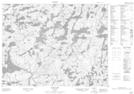
Maps showing Pickerel Creek, Kenora, Ontario
Pickerel Creek is a River located in Kenora, Ontario.
- Latitude: 50° 14' 30'' North (decimal: 50.2416666)
- Longitude: 93° 12' 41'' West (decimal: -93.2113888)
- Topography Feature Category: River
- Geographical Feature: Creek
- Canadian Province/Territory: Ontario
- Location: Kenora
- Atlas of Canada Locator Map: Pickerel Creek
- GPS Coordinate Locator Map: Pickerel Creek Lat/Long
Pickerel Creek NTS Map Sheets