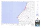
Maps showing Boiler Beach, Bruce, Ontario
Boiler Beach is a Beach located in Bruce, Ontario.
- Latitude: 44° 9' 43'' North (decimal: 44.1619444)
- Longitude: 81° 39' 18'' West (decimal: -81.6549999)
- Topography Feature Category: Beach
- Geographical Feature: Beach
- Canadian Province/Territory: Ontario
- Location: Bruce
- Atlas of Canada Locator Map: Boiler Beach
- GPS Coordinate Locator Map: Boiler Beach Lat/Long
Boiler Beach NTS Map Sheets