Maps showing Devil's Punch Bowl, Wentworth, Ontario
Devil's Punch Bowl is a Valley located in Wentworth, Ontario and has an elevation of 154 meters.
- Latitude: 43° 12' 44'' North (decimal: 43.2122222)
- Longitude: 79° 45' 28'' West (decimal: -79.7577777)
- Topography Feature Category: Valley
- Geographical Feature: Ravine
- Canadian Province/Territory: Ontario
- Elevation: 154 meters
- Location: Wentworth
- Atlas of Canada Locator Map: Devil's Punch Bowl
- GPS Coordinate Locator Map: Devil's Punch Bowl Lat/Long
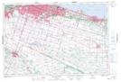
Devil's Punch Bowl NTS Map Sheets